-
Tour Program
-
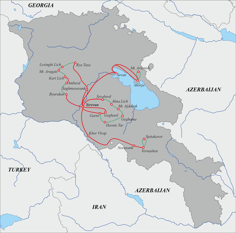
Map of the tour
-
Notes and suggestions
-
Quotation request
<
>
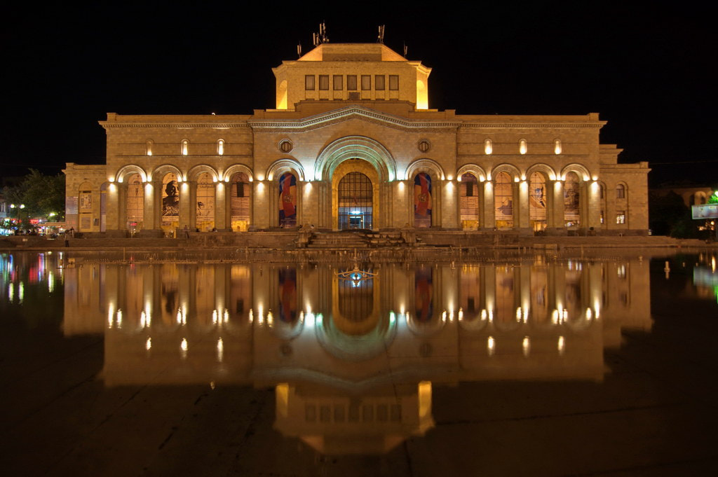
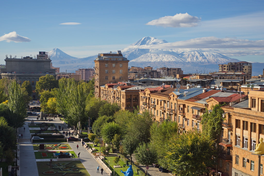
Day 2. Yerevan - Sevan - Trekking to Mt. Artanish - Yerevan city tourAfter breakfast, departure for Lake Sevan, visit to the Sevan peninsula to visit the monastery of Sevanavank. Continuation to the village of Shorja, on the slopes of Mount Artanish, the highest peak on Lake Sevan and trek to the top from where a spectacular view opens over the whole of Lake Sevan. Return to Yerevan early in the afternoon and tour of the city of Yerevan with Victory Park, which houses the huge statue of Mayr Hayastan (Mother Armenia) and from which you can admire the best view of the city. Continue to the Cascade complex, a monumental staircase that houses the modern art collection of Gerard Cafesjian. Walk through the center of Yerevan crossing the Armenian Opera Square and continuing along Northern Avenue, the pedestrian shopping street, to Republic Square, surrounded by the most beautiful buildings in the city, where Stalinist style meets architecture Armenian, and where the dancing fountain show takes place every evening in summer. Overnight in Yerevan.
Trekking to Mt. Artanish:
Start elevation: 1900 m End elevation: 2461 m Approximate distance: 7,5 km Elevation: 559 m (gain) / 617 m (loss) |
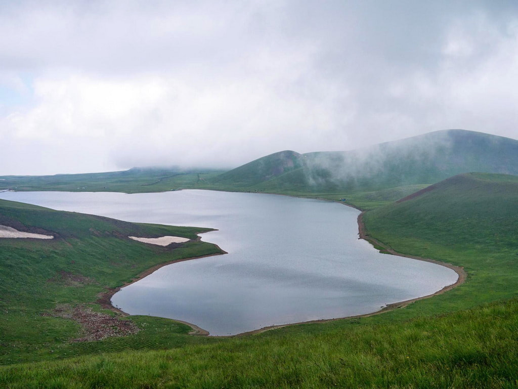
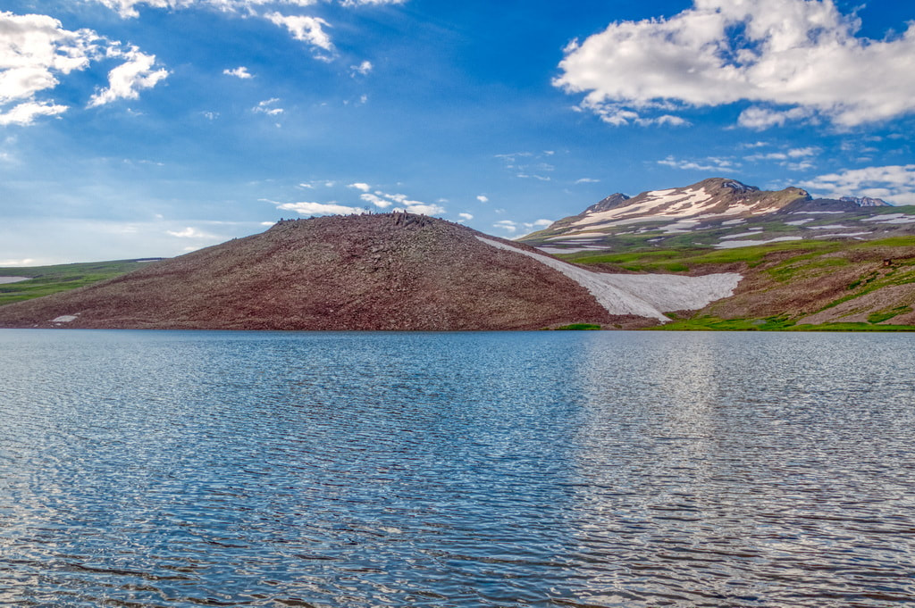
Day 3. Yerevan - Sevaberd - Akna LichDeparture in the morning from Yerevan in the direction of Sevaberd, a small village in the Kotayk region. Trekking from Sevaberd to Akna Lich, a small lake located 3030m above sea level. The area is full of fragrant flowers and plants, a place where the mountains and the sky seem to have been reflected in the lake for an eternity. A Yezidi Cemetery Memorial is also located near Lake Akna.
The path is long and the road is covered with sandstone, with springs of spring water along the way. Along the way you will probably see many birds, especially eagles. Overnight in a tent near the lake. Trekking to Akna Lich:
Start elevation: 2065 m End elevation: 3030 m Approximate distance: 15 km Elevation: 965 m (gain) |
Day 4. Akna Lich - Trekking to Mt. ajdahak - Geghama PlateauDeparture from Aknalich for a trek to Ajdahak mountain (3613m), the third highest mountain in Armenia and the highest peak in the Geghama mountain range. A large number of rock carvings among the best preserved in the Republic of Armenia have been found here. Most of the images depict men in hunting and fighting scenes but also dance scenes, celestial bodies and phenomena such as the Sun, the Moon, the stars. Continuation of the trek to the Plateau of the Geghama Mountains at an altitude of 2900 m. Overnight in tent.
Trekking to mt. Ajdahak and to Geghama Plateau:
Start elevation: 3030 m Maximum elevation: 3613 m End elevation: 2900 m Approximate distance: 15 km Elevation: 583 m (gain) / 713 m (loss) |
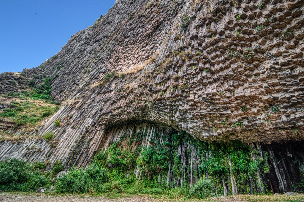
Day 5. Gheghama Plateau - Khosrov Reserve - Havuts Tar - Garni - Geghard - YerevanDeparture for the trek that descends from the Geghama plateau to the ruins of the Havuts Tar monastery and ends at the Garni gorge. Havuts Tar is a monastic complex located on the top of a mountain on the left bank of the Azat River, an important cultural and religious center of medieval Armenia. Continuation to the gorge of the Azat river, nicknamed the Symphony of the Stones for the columnar basalt formations in the form of organ pipes that line the walls of the canyon. The trek ends in the village Garni to visit the temple of Garni, a Hellenistic Roman temple from the 1st century and the only one to survive after the Christianization of Armenia in the 4th century AD. After the visit, continuation to the Geghard monastery, (UNESCO World Heritage Site), beautifully located in a narrow gorge and partially carved into the rock. The name of the Monastery, Geghard, in Armenian language means "spear", as the spear that pierced Christ's side on the Cross was kept here for centuries. In the evening, return to Yerevan and overnight.
Trekking to Garni:
Start elevation: 2900 m End elevation: 1500 m Approximate distance: 26 km Elevation: 1400 m (loss) |
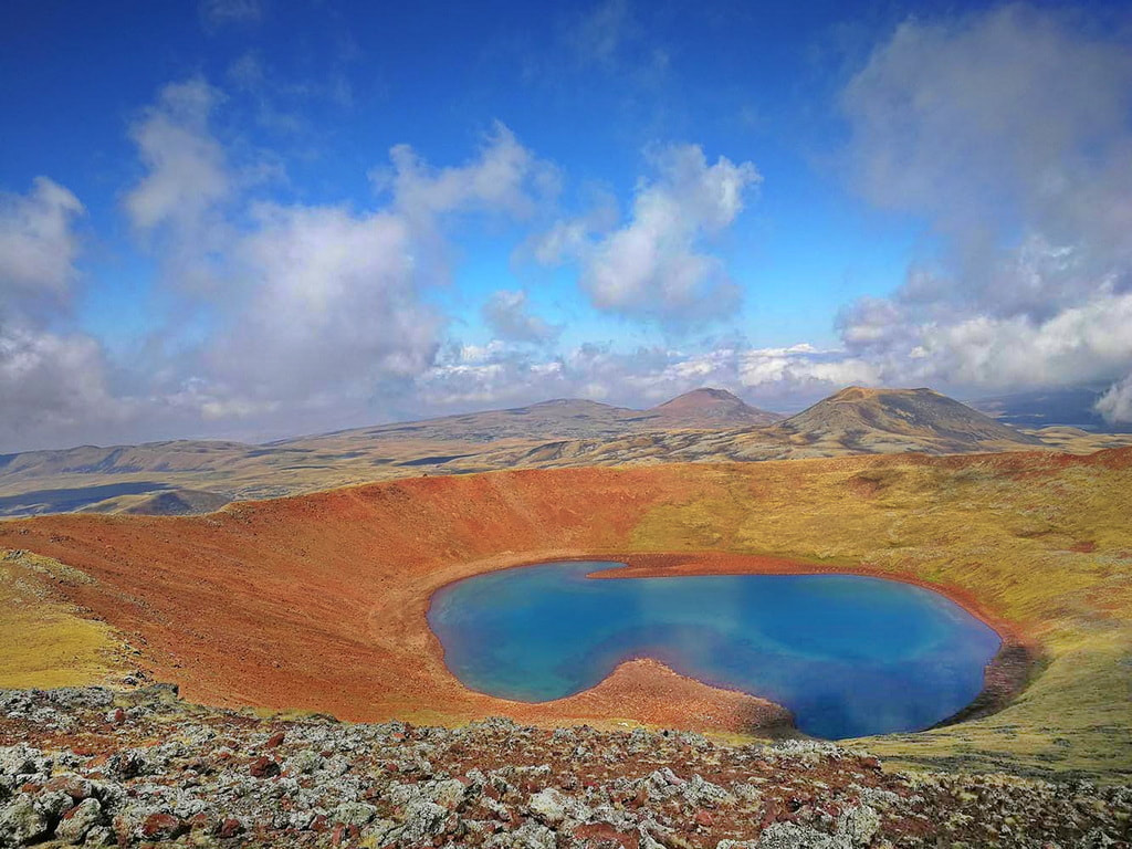
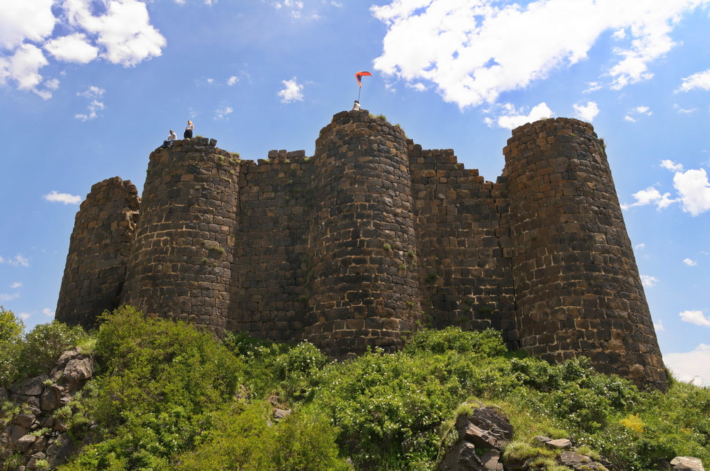
Day 6. Yerevan - Byurakan - Amberd - Lake KariAfter breakfast, drive to Byurakan. From here, a trek will lead to Amberd (4km), "the Fortress in the clouds", dating back to the 7th century and located at 2130m above sea level on the slopes of Mount Aragats (the highest in Armenia), which was attacked over the centuries but that only Tamerlane's army managed to conquer. Continuation by car to Lake Kari, located at an altitude of 3402 m. On the eastern side of the lake there is an equipped weather station where you will stay overnight in a tent.
Trekking to Amberd:
Start elevation: 1550 m End elevation: 2130 m Approximate distance: 4 km Elevation: 580 m (gain) |
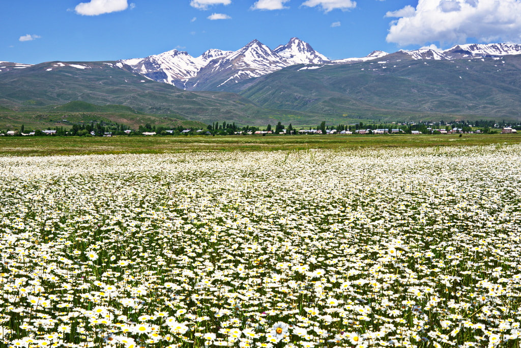
Day 7. Lake Kari - Western summit of mt. Aragats - crater of Mt. AragatsWake up early in the morning and, after a packed breakfast, start the trek for the ascent to the western peak of Mount Aragats. Mount Aragats is the highest point in Transcaucasia: it is an extinct volcano, which dominates the central Armenian plateau and which can also be seen from Yerevan. It is made up of 4 peaks, the highest of which is the northern one (4090m), while the lowest is the southern one (3879m). According to some scholars, the name Aragats is associated with Aramanyak, one of the sons of Hayk, the mythical progenitor of the Armenian lineage, while according to another version, Aragats takes its name from the ancient Armenian divinity Ara, and probably means Throne of Ara. Descent towards the crater and overnight in a tent around 3600m.
Trekking to Mt. Aragats Western Summit:
Start elevation: 3250m Maximum elevation: 3995 m End elevation: circa 3600 m Approximate distance: 7 km Elevation: 745 m (gain) / 395 m (loss) |
Day 8. Crater of Mt. Aragats - Northern summit of mt. Aragats - Lake LessingPacked breakfast and trekking to the northern peak of Mt. Aragats (4092m), the highest point in today's Republic of Armenia. This will be a very busy day because the northern peak of Aragats is the most difficult to reach and requires serious preparation to complete the ascent. Once you reach the top, the descent begins to Lake Lessing at 3200m where you will spend the night in a tent.
Trekking to Aragats Northern Summit:
Start elevation: circa 3600 m Maximum elevation: 4092 m End elevation: 3200 m Approximate distance: 10 km Elevation: 490 m (gain) / 890 m (loss) |
Day 9. Lake Lessing - Yazidi villages – Saghmosavank – YerevanPacked breakfast and trekking downhill to the villages of the Yazidi ethnic minority, semi-nomadic shepherds of Kurdish ethnicity from the area of Iraqi Sinjar, who settled in Armenia around the sixteenth century after the persecutions suffered in their land for the religion they profess: a unique and ancient cult derived from Zoroastrianism with Islamic and Christian influences. Drive to Saghmosavank Monastery, the Monastery of Psalms, beautifully located on the edge of the Kasagh River Gorge. Return to Yerevan, visit to Tsitsernakaberd (the Fortress of the Swallows), the Memorial of the Armenian Genocide which took place in 1915 at the hands of the Ottoman Turks. Overnight in Yerevan.
Trekking downhill to Yazidi villages:
Start elevation: 3200 m End elevation: 2000 m Approximate distance: 20 km Elevation: 1200 m (loss) |
Day 10. Yerevan - Khor Virap - Spitakavor - Proshaberd - Noravank - YerevanAfter breakfast, departure by car to the monastery of Khor Virap, dominated by the snowy profile of the grandiose Mount Ararat, in a suggestive position near the border with Turkey. The fortified monastic complex houses inside the well-prison (Khor Virap means "deep well") in which in the third century St. Gregory the Illuminator, the evangelizer of Armenia. Trekking from Vernashen village to Spitakavor monastery, built in the 14th century and decorated with some beautiful bas-reliefs attributed to the architect and sculptor Momik. The monastery, due to the countless flowers that surround it in spring, is also called Tsaghkavank. The church dedicated to the Holy Mother of God and the perimeter walls of the Gavit remain of the complex. Continue the trek to Proshaberd, a 13th century fortress named after its founder, Prince Prosh. Continue by car to the Noravank monastery, the work of the architect Momik, surrounded by rugged gray and red rocky mountains, with inside the two-storey church, unique in all of Armenia, by Surp Astvatsatsin, richly decorated with bas-reliefs . Return to Yerevan and overnight.
Trekking to Proshaberd:
Start elevation: 1540 m End Elevation: 2380 m Approximate distance: 17 km Elevation: 840 m (gain) / 840 m (loss) |
- Trekking routes and their travel times depend a lot on the possibilities of travelers, on how much and how they are willing to walk and must also take into account the weather conditions.
- The program may be subject to changes in the event of adverse weather conditions and the routes may also be shortened at the request of travelers. In any case, it will be unquestionable choice of the instructor to decide how to do or how to possibly modify the program so that the excursions can be done in total safety.
- The trip is suitable for experienced walkers and, due to the difficulty of reaching the northern summit of Mount Aragats, it is only suitable for those who are well trained in mountain walking.
- It is advisable to bring trekking shoes, poles if needed, a sleeping bag and clothing that takes into account the temperature variations especially in the regions outside Yerevan, even in summer.
- Any lunches during the excursions will be organized in peasant houses, with villagers or in small inns. On some days, if times require it or if it is not possible to find a town nearby, such as during the days on Geghama or Aragats, packed meals will be organized.
- The Vernissage market is open every day but can be visited at its maximum extent only on Saturdays and Sundays.
- The itinerary includes some overnight stays in tents that will be provided by our organization.

